
WHAT IS ICAO GIS?
The ICAO GIS website is an enormous repository of updated aeronautical data that enables users to query, analyze and obtain geospatial information. ICAO GIS provides a foundation for mapping and analysis, to help users understand patterns, relationships, and geographic context.
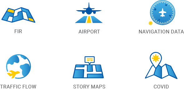
Our GIS covers six data areas :
FEATURE GIS TOOL AND PRODUCT
The ICAO GIS platform will encompasses various GIS online tools, interactive maps, and navigation capabilities. FlightVector APP and FIR (Flight Information Region) are two ICAO GIS feature products:
FlightVector is the vital web-based tool on the GIS website with the distinct advantage of being able to enable users to perform spatial analysis and visualize navigation data more efficiently. It contains many interactive maps, making it possible to explore with greater detail and multiple search and select functions. Not only does it have 'element filters', to turn off/on some elements, but users may also add their own data layers.
It is a navigation tool that is updated each month and offers dynamic rendering, element selecting, element type filtering and element searching.
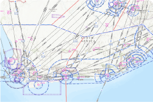
Flight Information Region (FIR) is an airspace of defined dimensions that provides flight information and alerting services. FIRs are critical elements in the aviation planning activities. ICAO FIR information is comprised of data and amendments that have been collected since 1947. The data is compiled in Shapefile format for easy process and analysis.
FREE MAPS
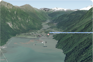
Airports near mountains with contour runways in 3D
ICAO starts the analysis with more than 9,724 significant aerodromes. The aim is to find the difference between the aerodrome elevation and the nearest contour Digital Terrain Model (DTM), elevation higher than 2,000 feet and close to the runway.

ICAO Traffic Flow 2018 for 3DFX DUBAI
Flight from departure to destination in 3D animation. ICAO Analysis helps to understand the future of aviation. A variety of miscellaneous benefits accrue with many kinds of traffic representations.

Top 40 Busiest Airports by Movements 2018
ICAO Traffic Flow dashboard 2018 with many unique query and export functions. ICAO analysis helps to understand the future of aviation. A variety of miscellaneous benefits accrue with various parts.
MOST POPULAR MAPS
ICAO FlightVector version 3 (monthly updates)
ICAO FlightVector V3 is the main application and provides a unique experience for regularly obtaining the latest aeronautical data. It comprises many layers that enables you to query, explore, and analyze aeronautical data. You can add files directly in different formats such as CSV, KML, GeoJSON. You can also add web layers, add ArcGIS REST Services, save and export your PDF map.
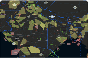
ICAO civil and military cooperation
Streaming overlay (Real-Time) over Flight Information Region (FIR) can be used for planning air operations. It will assist in managing the airspace between civil aviation and military air space and to better use many zones near significant traffic flow.

ICAO Map Maker (monthly updates)
ICAO Map Maker V3 creates a personalized map with all the sub-layers. It provides monthly updates, information on aeronautical data and attributes. It allows you to create your own maps, explore data, reorder layers and see the on-off visualizations.
| |
|
PRODUCT OFFERING AND PRICING
|  |
|  |
|  |
 | Notice to users: By registering with our service, you are agreeing to our terms and conditions. A subscription or GIS product purchase will require signing a licensing agreement. |
Notice to users:
By registering with our service, you are agreeing to our terms and conditions. A subscription might require signing a licensing agreement for certain GIS purchases.